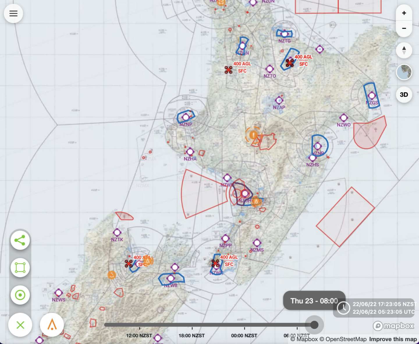
A handy new tool is out, developed by the New Zealand Defence Force (NZDF) and Aeropath. Think of it as a national low level airspace hazard register, on a selection of base maps including the VNC.
The primary function is for the NZDF’s own identification/ communication of low level hazards in uncontrolled airspace. But, those same activities are also relevant for us, such as NZDF operations, RPAS (drones), temporary hazards via NOTAM, identification of permanent hazards (which users can identify such as windmills, wires etc. which are verified and recorded within Aeropaths National Hazard Database) and other airspace users who have filed their low-level activities/plans.
Use of the system is open to all airspace users, it is free, and of course, voluntary.
Joining is super easy, via this link, all you need is a pilots licence as validation. Have a play.
A few handy tools of note are being able to get notifications (email/SMS) if an operation is planned in an area you set. The other useful feature, as part of your pre-flight kit, is being able to graphically see what airspace users have planned throughout the day (via a time slider at the bottom of the browser).
The system is steadily gaining momentum/uptake. Features are being updated/added including integration work with EFB developers (which would be fantastic). We are encouraged to pass on feedback to the Flight Advisor developers. Let us know what you think.